The last phase of the restoration of Plymouth’s Town Brook is underway. Work began in 2002 with the removal of dams from the brook’s 19th century industrial past. The last phase of the project will include the dredging of Jenny Pond (which is happening now), reconstruction of the pond bridge, a new fish ladder and reworking of the paths that lead to and through Brewster Gardens.
Town Brook played an important part in the settlement and development of Plymouth, but we shouldn’t neglect the historical importance of several other brooks throughout our downtown area. I was reminded of this on a recent visit with a potential new client.
The client is looking to expand a building he owns on Samoset Street. Because of all the historical trivia that lives in my head, the first question I asked was if the brook ran through a pipe under his back yard.
The brook in question is First Brook, the first significant water way north of Town Brook. First Brook begins in a small spring fed pond behind homes on the southern end of Standish Avenue The brook is piped from the pond’s outlet until it crosses Standish as it heads towards the harbor.
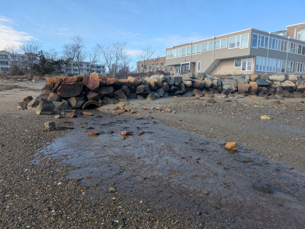
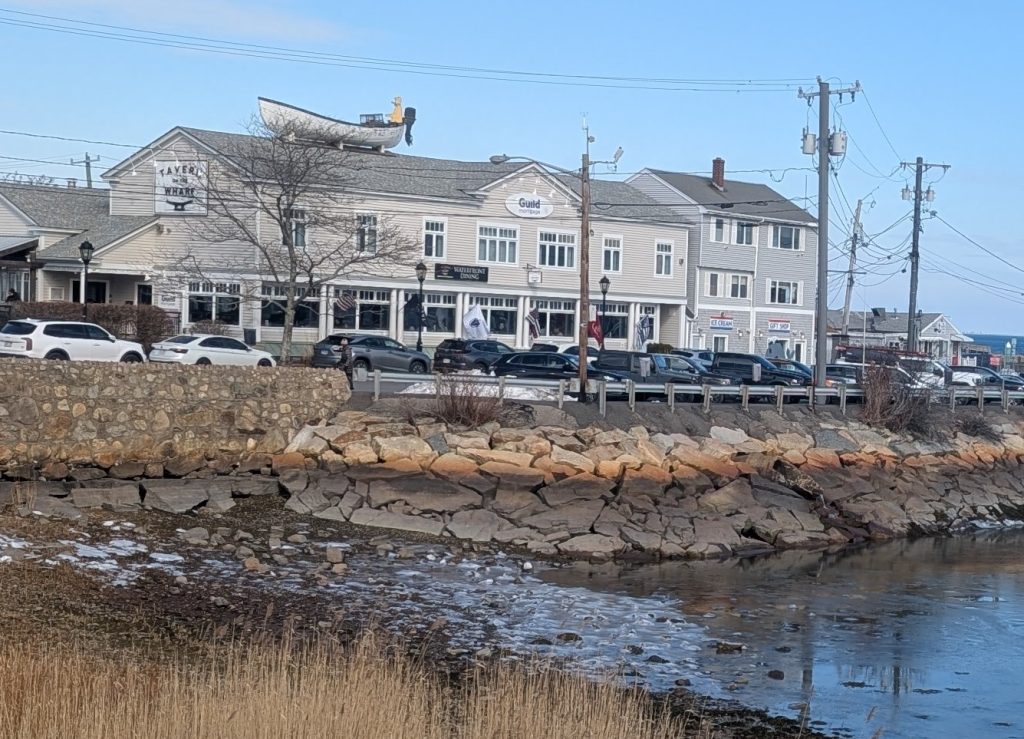
The main open-air section of the brook, which is also known as Shaw’s Brook, runs behind the Cape Auto complex before it enters another pipe, which crosses to the south side of Samoset Street at Allerton Street. The pipe then crosses Court Street and runs beneath the Brick Block building at the corner of South Park and Court. It briefly sees “daylight” as it runs uncovered in the basement of the Dellaria Salon (Blossom & Root, in the former Golden Gull Studios). David Buckman, former owner of Golden Gull, jokingly told me he would offer a fishing rod to anyone who cared to try their luck. Piped under the nearby Sun Dynasty restaurant, (site of a former mill powered by the brook) the waterway emerges opposite Tavern on the Wharf and spills into the harbor.
Moving a little further north, Second Brook no longer exists on the surface. Its origin point began at a small spring-fed pond that once existed at the northern corner of Murray and Court streets. Named Second Brook by the early settlers, its name changed over time. William Davis, Plymouth’s unofficial historian during the late 19th century, wrote several books that recalled his life in Plymouth One of his accounts recalls the pond as a watering hole for horses. He knew it as Faunce’s Brook. Later, the brook would come to be known as the Woolen Mill Creek after the mill complex it powered for a time. Today, the brook remains largely underground and has become part of the street drainage system. It empties into the harbor at the shore immediately to the north of the beginning of the breakwater.
The last of the early-named brooks, as you might have guessed, was Third Brook, which begins its life in a long-capped spring at the corner of Gould Road and Olmsted Terrace. Piped under Olmsted Terrace, the brook finds its way into Dyers Pond, then travels via pipe to Benny’s plaza, which is also home to Cold Spring. The original spring pedestal along Court Street still exists.
During the Pilgrim era, the Benny’s Plaza area was home to a pond identified on the 1701 map as Reed Pond. It eventually turned into a grassy, wet meadow. In the 1950s, my grandfather worked on the construction of the Benny’s building and recalled driving piles into a swamp to provide a solid footing for it. Third Brook, or Cold Spring Brook as it was now known, no longer ran free. It briefly served as a power source for a small mill on Water Street, close to Lothrop Street. What’s left of the brook exits into the harbor just south of the former Ocean Spray headquarters on Water Street.
The only free flowing brook north of Town Brook is not far from Third Brook. Originating at a very small spring-fed pond near the intersection of Knapp Terrace and Court Street, Eel Creek flows behind the homes on the north side of Knapp Terrace, under the rail trail, into the harbor at the north end of the Nelson Street park.
The last two northern brooks in Plymouth share a long history of rerouting, piping and altered courses. They also changed the face of North Plymouth as we know it. It’s hard to determine their original courses, as early maps of Plymouth tend not to detail that area. But both Hedge Brook and Nathan’s became the power source for the Plymouth Cordage Company. Hedge Brook is believed to originate somewhere in the vicinity of Colony Place. It is definitely part of the drainage basins that surround the Route 44 ramps that connect to Commerce Way. The brook makes its way to Sawmill Pond and Hedges Pond. At some point, the brook was connected to Store Pond to provide additional water flow for Cordage. Hedge Brook flows openly along the northern side of Hedges Road before spilling into the harbor.
In 1824, Bourne Spooner chose Nathan’s Brook to power his endeavor, the Cordage Company. The source of Nathan’s is difficult to determine. Current maps look to swampy areas in Kingston that also may serve as the origin point of Kingston’s Smelt Brook. (I would welcome information on this mystery.)
A good portion of Nathan’s Brook runs openly in North Plymouth behind the homes on the southern portion of Spooner Street. The brook wraps behind the old fire station and runs a course parallel to Bourne Street. It makes a sharp turn into a pipe and empties into Store Pond. Its course then takes it into the Mill Pond on the Cordage property. Piped from that pond, Nathan’s Brook enters the harbor just north of the Cordage Pier.
Returning to Town Brook, it’s worth noting that it was fed by several tributaries that have long since disappeared. The first tributary, heading west, was known as Barnes Creek. The creek began somewhere close to the Nathaniel Morton school playground. The only evidence of the creek today is the rust-colored discharge adjacent to the Town Brook service station. The next tributary became the damned Jenny Pond, but the pond was originally a creek known as Dunham’s Brook. A little further north a third tributary known as Little Brook or Prison Brook flowed from Murdock’s Pond before it was relegated to a pipe.
Town Brook’s source is Billington Sea. An ancient brook known as Cotton Brook once flowed into Billington Sea. Today, the remnants of Cotton Brook live as drainage and flood ditches that surround the bogs on the western reaches of Watercourse Road.
South of Town Brook, our ancient streams have survived slightly better than their northern cousins. Springs in the vicinity of the Harlow Old Fort House and the 1672 Doten house were long ago piped and directed to the small pond at Stephens Field. The recent renovations there exposed a portion of the brook that flows from the pond to the harbor.
The source for Wellingsley or Hobs Hole Brook begins in the spring feed trout hatchery located on Nook Road. Flowing openly along the north edge of Nook Road, the brook crosses Sandwich Street at the location of the current sewer pumping station. The brook once powered a multi-story factory that lived in the same spot as the pumping station. During the spring, for a short time, the brook’s banks are covered with thousands of blue flowers. It’s a sight worth seeing.
The next brook south of Hobs Hole may be the Cobbs Hollow Creek identified by Davis in yet another account of his childhood. It may be misnamed but a brook does run from the intersection of Hilldale Road and Warren Avenue. Its ancient historical route may have begun on the other side of Warren Avenue behind the homes on the south side of Hilldale, but extensive earth moving may have changed that.
Our last brook before we encounter the Eel River is one of its tributaries. At one time, Fuller Brook may have run behind the houses on the south side of Cliff Street, and, like Cobbs Hollow Brook, extensive grading may have disrupted the river’s original course. Fuller Brook runs free from Warren Avenue along the Eel River Beach Club and then joins the Eel River.
No doubt, these brooks at one time were home to herring, eels, and trout, but time and progress have forever changed their courses and ecology. It took 400 years to erase the sins done to Town Brook. Perhaps our other brooks may get the same treatment in the future.
And that client on Samoset Street? It took a few days and lots of digging but help from town archivist Conor Anderson revealed First Brook’s altered path. Anderson was instrumental in finding old maps that showed its course when it was piped in the late 1890s. The brook was not piped through the client’s property.
So why was it piped in the first place? The selectmen from that period were upset that the brook had degraded into an open flowing sewer. It was ordered to be piped and drained to the harbor, sewage and all.
Architect Bill Fornaciari is a lifelong resident of Plymouth (except for a three-year adventure going west as a young man) and is the owner of BF Architects in Plymouth. His firm specializes in residential work and historic preservation. Have a question or idea for this column? Email Bill at billfornaciari@gmail.com.